Nearly 500 crashes reported in Calgary’s record-breaking first snowfall
Posted Nov 25, 2025 7:38 am.
Last Updated Nov 25, 2025 6:37 pm.
Monday was manic for some Calgarians thanks to the long-anticipated arrival of a hefty dump of snow.
660 NewsRadio meteorologist Kevin Stanfield says the city actually broke a decades-old snowfall record for Nov. 24.
“Calgary set a new snowfall record yesterday, hitting 10.2 centimetres, beating 2001’s previous record of 9.2 centimetres,” he said.
Actual amounts varied depending on where in the city you were — Stanfield said totals ranged from seven to 18 centimetres.
He adds, in neighbouring communities, Cochrane recorded 15 centimetres and Airdrie got between 10 and 13 centimetres.
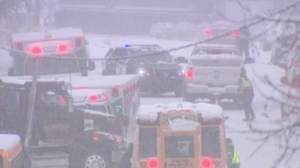
Calgary police responded to nearly 500 crashes throughout the day.
Of those, three-dozen caused injuries and more than 75 were hit-and runs.
Thankfully, there were no injuries as a result of the hit-and-runs.
The snow is likely to stick around for at least the next few days, as cold temperatures persist.
Tuesday’s forecasted high is – 3 C. The morning will be a chilly one, thanks to a wind chill making it feel more like – 8 C. Environment and Climate Change Canada (ECCC) says it will warm up to – 7 C in the afternoon before colling to – 15 C overnight.
Wednesday will be much of the same, according to ECCC. A bitter wind chill will have it feeling like – 14 C in the morning before warming up to – 6 C in the afternoon.
Thursday could see a return of the flurries — ECCC says there’s a 30 per cent chance of some snow, though no word yet on exactly how much.
Heading into the weekend it will warm up a bit — a high of – 8 C on Friday, – 6 C on Saturday, and 5 C on Sunday.
On Monday, the first day of December, Calgary is set to defrost with a high of 5 C and a mix of sun and cloud.
Listen to 660 NewsRadio or tune into CityNews 24/7 for the latest in breaking news, traffic, and weather