Snowfall warning for Calgary as Alberta Clipper targets city
Posted Feb 26, 2026 8:57 am.
Last Updated Feb 27, 2026 5:39 pm.
A brief mid‑week thaw is about to give way to another round of winter as a fast‑moving Alberta clipper pushes toward Calgary, bringing snowfall, colder temperatures, and difficult travel conditions.
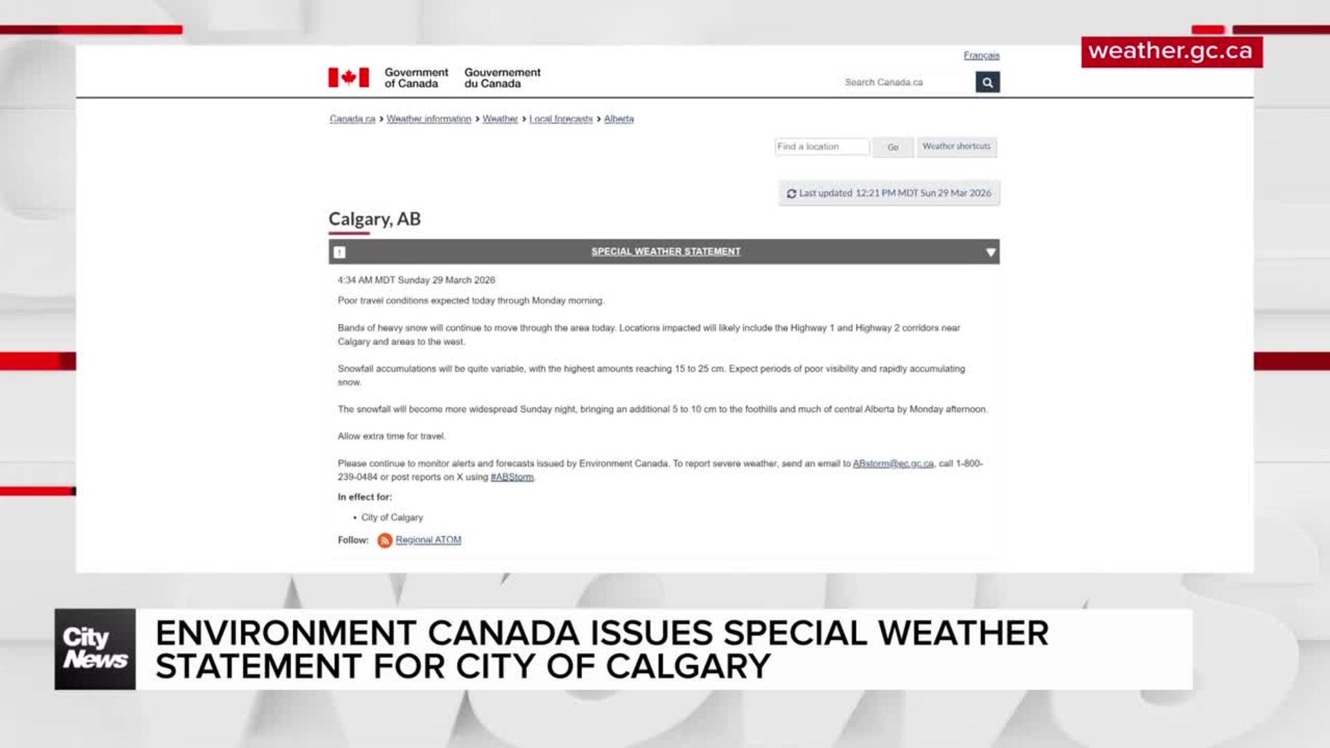
Environment Canada has issued a snowfall warning for Calgary and surrounding areas, calling for 15 to 30 centimetres of snow between Thursday night and Saturday morning.
Calgarians who enjoyed the short-lived warm‑up after last week’s bitter cold and heavy snow should brace for the wintry weather to begin late Thursday.
“We have a large Alberta clipper that’s expected to make its way across northern Alberta and out to Manitoba by the weekend,” says 660 NewsRadio meteorologist Kevin Stanfield. “It’s going to dredge snow across the foothills for the next several days.”
The snow will begin over west-central Alberta Thursday evening and arrive in Calgary later in the night, according to Environment Canada.
The snow is expected to intensify early Friday and continue throughout the day before tapering off near midnight Friday. The Foothills regions are forecasted to see the heaviest accumulation.
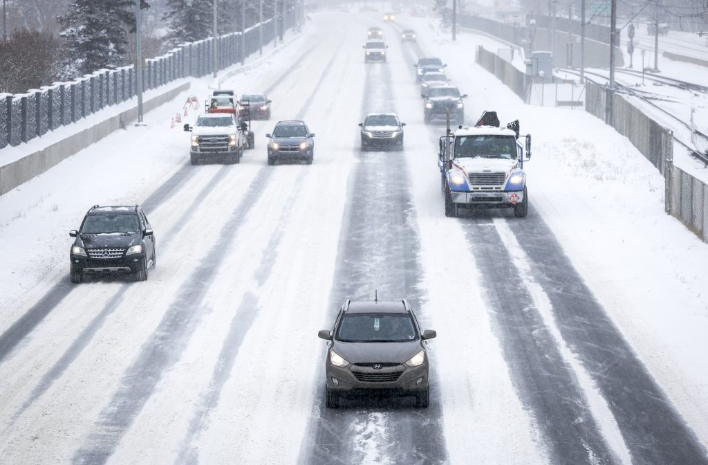
Travel is expected to be challenging, with reduced visibility and rapidly deteriorating road conditions. Drivers are urged to allow extra time and prepare for winter hazards.
While the storm will bring a sharp return to winter, the weekend marks the beginning of a warming trend. By Sunday and Monday, temperatures are expected to climb well above freezing.
Thursday night will see a low near -7 C with wind chill near -11. Temperatures are expected to fall to -14 C by Friday afternoon, with wind chill feeling closer to -22.
Saturday will see a slight warm-up with a high of -7 C. Then it is expected to be much warmer Sunday with a high of 7 C, and then a high of 9 C expected on Monday.
Listen to 660 NewsRadio or tune into CityNews 24/7 for the latest in breaking news, traffic, and weather